
High-Resolution Aerial Thermography
Discover how infrared cameras on helicopters and fixed-wing aircraft open up new possibilities for wide-area thermal analysis from above. In our online event, you'll learn about key applications, technical requirements, and the benefits of both cooled and uncooled systems. See how airborne thermography supports environmental monitoring, infrastructure inspection, and more – with the right equipment and expert know-how.


Current Appointments
High-Resolution Aerial Thermography
Aerial thermography: Definition, benefits, types, presence and future
Applications for thermography in airborne remote sensing
Challenges of aerial thermography and technical requirements for an IR camera system
Complementary technical lectures
"The IGI EcoMapper – high-precision aerial survey in five spectral bands" from Dr. rer. nat. Jens Kremer, Manager R&D, IGI mbH, Germany
"Utility and Environmental Inspections" from Adam Boniecki, Business Development, Trakka Systems AB
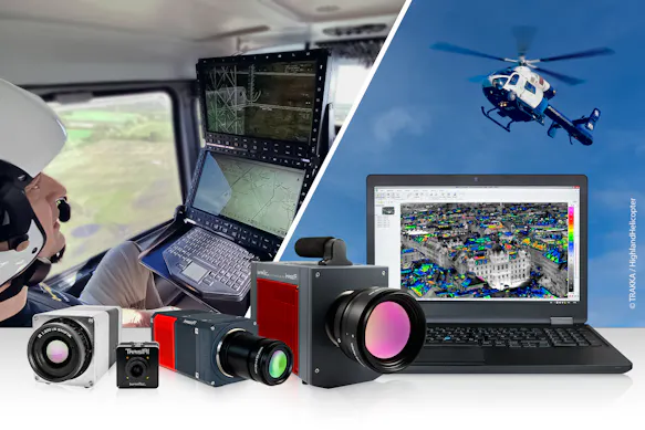
The Infrared Eye in the Sky – Aerial Thermography with InfraTec
By utilizing a helicopter equipped with a thermal camera, gimbal-supported aerial thermography gets a third dimension through infrared. From an elevated position an infrared camera can visualise a large thermographic overview for a variety of applications. Depending on the actual mission plan fixed wing aircraft can provide further options for those applications as well, of course.
Learn more about airborne thermography in our online event "High-Resolution Aerial Thermography."
A Glance at the Event
Aerial thermography: Definition, benefits, types, presence and future
Applications for thermography in airborne remote sensing
Challenges of aerial thermography
Technical requirements for an IR camera system
Comparing cooled and uncooled camera systems
Important and relevant selection criteria
Accessories (hardware and software) needed to solve the measurement task
Complementary Technical Lecture
We are pleased to announce a technical lecture from thermography practice:
You’ll find more information here soon.


